

Picaro Publishing La Jolla Shores Topographic Slate
Guaranteed Safe Checkout


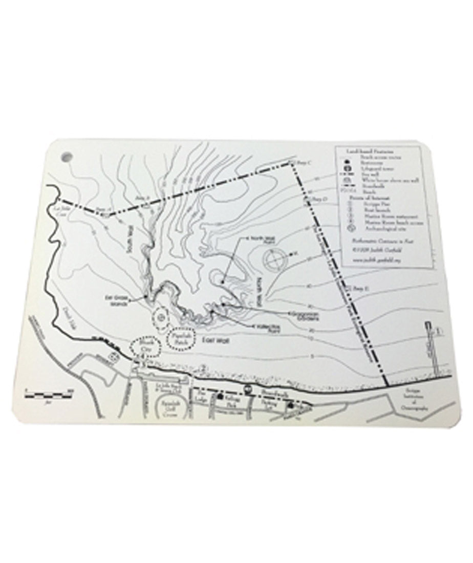
Overview
The La Jolla Shores Slate Topographic Map is a compact, waterproof dive slate designed to help divers navigate one of San Diego’s most popular dive sites. Featuring detailed topographic information from La Jolla Cove to Scripps Institution of Oceanography, this slate is an essential reference tool for planning and underwater orientation.
Key Features
- Topographic map layout provides a clear view of La Jolla Shores dive terrain
- Coverage from La Jolla Cove to Scripps includes key landmarks and dive areas
- Detailed site information helps with navigation and dive planning
- Waterproof slate construction allows use during dives and in wet conditions
- Compact 7" x 5" size easy to carry and attach to gear
Specifications
- Dimensions: 7 in x 5 in
- Material: Waterproof slate
- Location: La Jolla Shores, San Diego
- Coverage Area: La Jolla Cove to Scripps Institution of Oceanography
What’s Included
- La Jolla Shores Topographic Waterproof Dive Slate
Care & Return Policy
Rinse with fresh water after use and allow to dry completely before storage. Avoid scratching the surface to maintain map clarity and readability over time.
For full details on returns and eligibility, please review our Return Policy .
All orders over $50 ship for free. (* some exclusions apply)
150% Price Protection Policy.
Satisfaction Guarantee on all of our merchandise.
Authorized PADI dive center with expert staff.